Places
Lake Powell from Page: Antelope Canyon by Kayak, Boat Tours, Rainbow Bridge and the Dam
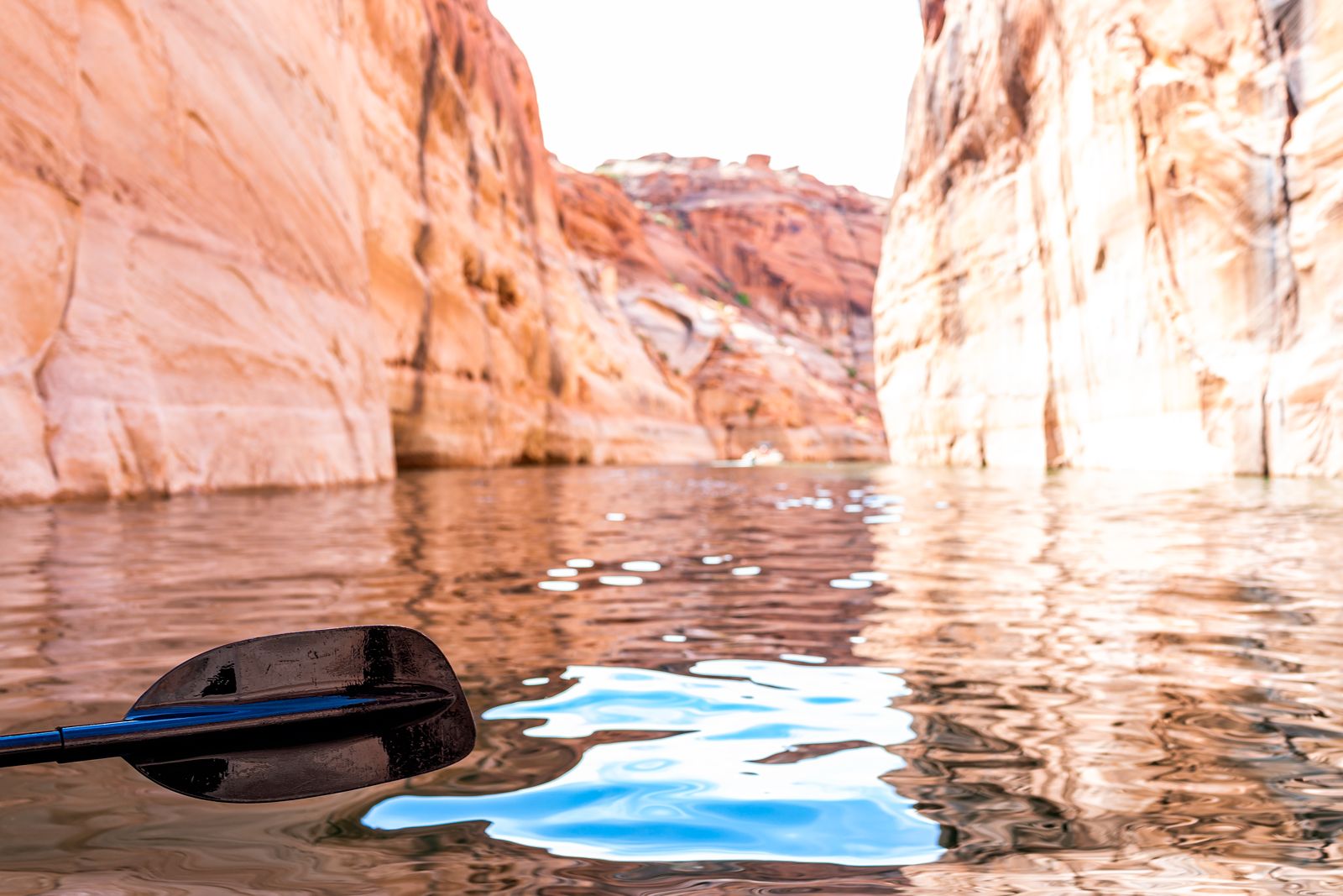
Lake Powell is the reservoir behind Glen Canyon Dam, a few miles from Page, Arizona, and it is the other half of Antelope Canyon. The famous slots that most visitors walk through on a Navajo-guided tour drain north toward the lake, and below Lower Antelope Canyon the canyon floor drops beneath the water. That flooded lower end is a long, high-walled side arm of Lake Powell that you can paddle into by kayak, then leave the boat and walk on into the narrows.
That is the best-known thing to do on the lake from Page, but not the only one. There are boat tours from two marinas, Rainbow Bridge, one of the largest natural bridges in the world, the dam and its visitor center, beaches and coves for paddling, and the cold, clear Colorado River below the dam. Below: how the lake came to be, what low water means for a visit, Antelope Canyon from the water, the boat trips, Rainbow Bridge, the dam, and the practical rules and seasons.
Lake Powell at a glance
| Nearest marinas | Wahweap, 8 miles (14 minutes) from Page; Antelope Point, 9 miles (15 minutes) |
| Park fee | $30 per private vehicle, valid 7 consecutive days, charged by Glen Canyon National Recreation Area |
| Lake level | 3520.77 ft on October 20, 2026, according to the National Park Service |
| Antelope Canyon by water | Kayak from the Antelope Point public launch ramp, which is open to paddlecraft only |
| Rainbow Bridge | About 50 miles by water from Page, about 3 hours each way by boat |
| Water temperature | About 47°F in January to about 80°F in August, by a Page outfitter’s figures |
How the lake came to be
Lake Powell is young. The Bureau of Reclamation’s photo record shows Glen Canyon Dam and its bridge under construction in 1963, and Lady Bird Johnson dedicated the dam in 1966. The water rising behind it drowned Glen Canyon, the long sandstone gorge of the Colorado River, and its side canyons, and Lake Powell filled completely in 1980. Glen Canyon National Recreation Area was created in 1972 to manage the lake and the land around it.
The lake takes its name from John Wesley Powell, the Civil War veteran who explored the river in three wooden boats in 1869. Most of it lies in southern Utah; only a small section reaches into Arizona’s Coconino County, where Page is.
The numbers are large. Reclamation says the dam rises 710 feet above bedrock, making it the second highest concrete-arch dam in the United States, after Hoover Dam at 726 feet. The lake can store 25.16 million acre-feet of water, which Reclamation describes as a bank account drawn on in times of drought. At full pool, by Reclamation’s figures as published by a Page operator, the lake is 186 miles long with 1,960 miles of shoreline.
Low water, and what it changes
Lake Powell is far from full. The Park Service says that since 2001, declining water levels from climate change and 20 years of drought have reshaped the shoreline, and on October 20, 2026 it listed the lake at 3520.77 ft. The effects show up in very practical ways:
- Launch ramps. The Antelope Point public launch ramp is closed to motorized boats and open to paddlecraft only, and several Wahweap ramps are the same.
- The Utah ferry. The state ferry across the lake does not run while the lake is below 3575 ft and is not expected to until further notice.
- Rainbow Bridge. The courtesy dock no longer reaches land; boaters beach and walk through muck to the trail at their own risk. The Park Service says the floating docks can be reattached once the lake rises above 3550 feet.
- Depth. For perspective, a Page kayak outfitter points out that even at low water the lake is still more than 400 feet deep.
Low water is not all loss. The same outfitter notes that some canyons are best explored at low levels, and that the falling water has revealed side canyons and viewpoints that may not be reachable again. But check the Park Service’s lake-level page before you plan a trip around a particular ramp or dock.
Antelope Canyon from the water
Below Lower Antelope Canyon, the canyon floor descends beneath the lake, and the lower end can be reached only by kayak, paddleboard or small boat. A Lake Powell boat-tour page describes it as a high-walled Navajo Sandstone side arm of the lake, over 10 miles long. The Park Service designates Antelope Canyon as a wakeless canyon at all times, which makes it calmer for paddlers than the open lake.
How far you can paddle depends on the water. Depending on the level, kayakers can paddle about 1 to 2 miles into the canyon (as of 2024), then beach and continue on foot into the slot. Kayak operators run guided trips that combine the two:
- Where they start. The Antelope Point public launch ramp, three miles east of Page on Highway 98 and then north. One operator stresses that it does not launch from the marina next door.
- How far you go. One outfitter’s hike-and-kayak tour paddles typically 5 miles round trip, depending on the water level, and the hike from the beach is about 2 miles (3.2 km) of flat rock and sand, about an hour round trip.
- How long it takes. Tours run four hours, with departures at 8:00 am, 9:00 am, 10:30 am and 1:00 pm Arizona time from that outfitter.
- What it costs. That outfitter lists $120 per adult and $100 per child aged 5 to 12, plus the $30 Glen Canyon vehicle fee.
The walking part is different from the guided slot tours up the road. The outfitter describes the hike as a mixture of rock and sand and very flat, and you walk into the narrows after a paddle, with wet, sandy feet. Operators set firm conditions. Participants must be able to get back into a capsized kayak with a guide’s help, which matters most in spring and late fall when the water is cold. From June to October the tours include time for a swim. And from July through mid-September flash floods are possible, so guides may shorten the hike if rain is forecast. The Navajo parks department’s warning applies here too: flash floods are most likely in the July to September monsoon but can occur in any month.
How this compares with Upper, Lower, Canyon X and Secret Antelope Canyon is set out in our guide to which Antelope Canyon to book.
Boat tours
The Park Service lists two bases for boat tours from Page: Wahweap Marina, run by the lake’s resort concession, and Antelope Point Marina, which offers multiple boat tour and charter options of its own.
The resort’s own list is a useful guide to what is on offer, and also to what is not:
- Antelope Canyon cruise. A 1.5-hour cruise from Wahweap Bay that follows the original river channel into the canyon, but the resort marks it unavailable until further notice.
- Rainbow Bridge tour. Also marked unavailable until further notice.
- Scenic Dam Cruise. A 90-minute trip to the face of Glen Canyon Dam.
- Canyon Princess dinner cruise. A two-hour evening cruise.
- Navajo Canyon. A trip past tall walls streaked with desert varnish, with a close view of the dam.
Because the schedules change with the water level, check which boats are running before you build a day around one. The $30 Glen Canyon fee applies to boat tours too; the resort notes it admits one private vehicle and all its passengers for 7 consecutive days.
Rainbow Bridge
Rainbow Bridge, sacred to the Navajo people, sits in its own national monument, run by the National Park Service from Glen Canyon. It covers just 160 acres, one of the smallest units of the National Park Service, yet close to 100,000 people make the trip each year. The Navajo parks department calls it the world’s highest natural bridge and gives its span as about 275 feet, with a thickness of 42 feet and a width of 33 feet.
Getting there takes commitment. The Park Service says you can reach it only by boat or by an approximately 14-mile hike around Navajo Mountain, which needs a Navajo Nation permit. By boat it is about 50 miles from Page, and the round trip, with about an hour at the monument, takes about seven hours. From the shore it is an approximately 1.2-mile hike to the bridge. There is no camping inside the monument, and it is closed from sunset to sunrise.
Geologically, the bridge is a cousin of Antelope Canyon. Its span is Navajo Sandstone, on a base of the older Kayenta Formation, and it was cut by a stream that steepened when the Colorado Plateau rose, around 5.5 million years ago, by some 3,000 feet (915 meters). Navajo Mountain, at 10,388 feet (3,148 meters), towers above it.
Glen Canyon Dam and the overlook
The dam is the easiest sight on the lake to reach. The Carl Hayden Visitor Center sits beside it on US Highway 89, with views down to the dam and across to the bridge, and admission and parking are free. Guided tours inside the dam were not running as of fall 2026, so check with the center before planning around one.
A short drive away, the Glen Canyon Dam Overlook is a free viewpoint on the canyon rim, reached by a walk of about 940 feet down rock steps; the whole stop takes 15 to 30 minutes. From there you see the dam, the steel arch of Glen Canyon Bridge, which carries Highway 89 across the canyon 700 feet above the river, and the Colorado River heading downstream toward Horseshoe Bend.
Paddling on your own
You do not need a tour to get on the water. The Park Service says there is no additional fee to launch a kayak in Glen Canyon beyond the park entrance fee, and paddlers can launch from ramps and from primitive beach areas when conditions allow. Lone Rock Beach, 12 miles north of Page on Highway 89 at the Utah border, is popular, and Wahweap’s coves are a common local day trip.
What the Park Service and local outfitters ask you to know:
- Camping. Allowed on the lake for up to 14 days with no fee or permit, but beyond 200 yards from a developed area you must carry an approved human-waste system.
- Cold water. A wetsuit is recommended from March to mid-May, and cold water is the outfitter’s top spring hazard.
- Lightning. The top summer hazard on open water.
- Slot canyons. In summer and early fall, keep hikes into narrow slots short, especially in the afternoon, because flash floods are hard to see coming from inside.
- Jumping. Scout first, keep jumps under 15 feet and never dive.
- Wildlife. Rattlesnakes and bark scorpions live here, and spring and late summer are peak rattlesnake seasons.
Remember that the land around the lake is not all National Park Service land. Antelope Canyon and Rainbow Bridge Trail sit within the Navajo Nation’s Lake Powell tribal park, and the Navajo parks department says all areas of the Nation are closed to non-Navajos without a valid permit; going without one counts as trespassing.
The river below the dam
Below the dam the Colorado River is a different world: clear, fast and very cold. A Page outfitter lists the river at around 46°F in every month of the year. The Park Service describes two ways to see it. A smooth-water raft trip floats from Lees Ferry up to Horseshoe Bend and back, and paddlers can bring their own boats: there is no put-in at the dam, so you launch at Lees Ferry and arrange a tow upstream, then float back. Everyone in a paddled craft must wear a Coast Guard approved lifejacket while underway. Lees Ferry is 43 miles by road from Page, about 50 minutes.
From the rim, the same stretch of river is the view at Horseshoe Bend, about 5 miles south of Page.
When to go
The lake follows the same desert calendar as the canyon. A Page kayak outfitter puts lake water at about 47°F in January and 46°F in February, warming to about 62°F in May and 70°F in June, and peaking near 80°F in August, with 76°F in July and September. It calls September to early November the best season for longer paddling trips, though September still brings monsoon storms.
- Spring: comfortable air, cold water and frequent wind.
- Summer: hot days, warm water for swimming, and afternoon storms from July.
- Fall: warm, calmer and quieter, the outfitters’ favorite.
- Winter: short days and cold water, for experienced paddlers only.
The month-by-month air temperatures for Page, and what the monsoon means for the slot canyons, are in our Antelope Canyon weather guide.
Fitting the lake into a Page trip
The lake rewards a full day, but it also fits around the canyon. Some workable shapes:
- Canyon by land and water. A morning Upper or Lower Antelope tour, then an afternoon kayak-and-hike from Antelope Point, so you see both ends of the same canyon.
- Dam and overlook. The visitor center, the dam overlook and Horseshoe Bend all sit along Highway 89 and fill an easy half day.
- A day on the water. A boat trip from Antelope Point Marina, or a paddle from Lone Rock Beach, with a stop at Horseshoe Bend at sunset.
If you are coming from Las Vegas or Phoenix, our guide to getting to Antelope Canyon covers the drive and the day tours, and remember that Page keeps Arizona time while the Navajo Nation and Utah observe daylight saving.
Frequently asked questions
Can you see Antelope Canyon from Lake Powell?
Yes. Below Lower Antelope Canyon the canyon floor runs under the lake, and kayakers can paddle about 1 to 2 miles in, depending on the water, then walk on into the slot. Guided hike-and-kayak tours leave from the Antelope Point public launch ramp.
Do you need to pay to visit Lake Powell?
Yes. Glen Canyon National Recreation Area charges $30 per private vehicle, valid for 7 consecutive days, and annual and national park passes are accepted. There is no extra fee to launch a kayak.
Can you still visit Rainbow Bridge?
Yes, but only by boat or a long permitted hike. At current lake levels the dock does not reach land, so visitors beach and walk to the trail, then hike about 1.2 miles. Check which boat tours are running, since the resort’s own tour was marked unavailable in October 2026.
How cold is Lake Powell?
By a Page outfitter’s figures, the lake is about 47°F in January and about 80°F in August. The Colorado River below the dam stays around 46°F all year.
Can you tour Glen Canyon Dam?
Not as of fall 2026, when guided tours inside the dam were not running. The Carl Hayden Visitor Center beside the dam, with free admission and parking, and the free dam overlook are open for views.